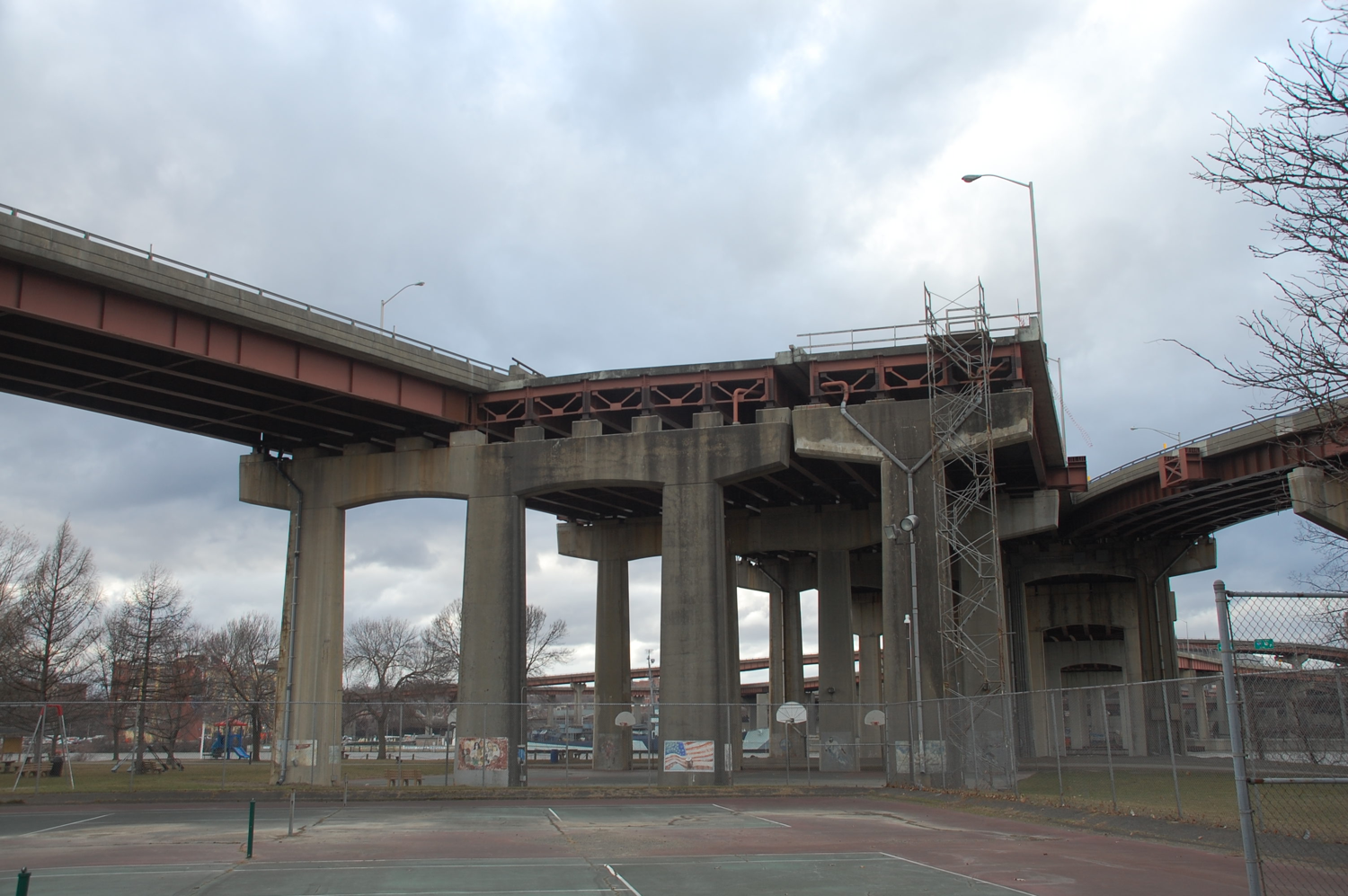
Dunn Bridge from the Rensselaer side. Few of the bridge users ever see this view. Photo by Richard Welty, © 2017.
I 687 would have run from the Corporate Woods Exit to the vicinity of Sand Creek Road and the Northway, extending to provide Airport Access. It would have carved a swath through existing neighborhoods of Colonie. The project died, in part, due to heavy neighborhood opposition. Note that the right-of-way was acquired by NY DOT, so the opposition was not from those who would lose their homes, but rather those who didn't want to live next to a freeway.
Exit 3 on the Northway was reserved for an interchange with I 687 just north of Sand Creek Road. This exit number has ended up being used for the new ramps to Albany Shaker on the west side of I 87.
The I 90 exit was built before the proposal was officially cancelled, making it an exit to nowhere. Picotte subsequently built the Corporate Woods office complex, taking advantage of the existing exit.
Some variations of the I 687 plan included a westward extension to Schenectady County. This extension was sometimes referred to as the Scotia Arterial or the Albany Schenectady Expressway.
It is sometimes said that 50 Wolf Road (the former DEC building, now home the DOT) was built where it was because it would interfere with the I 687 plan, which DEC reportedly opposed.
The problem with all this is that the proposal clearly had I 687 crossing Wolf Road north of Sand Creek Road, and the complex containing 50 Wolf Road is south of Sand Creek Road.
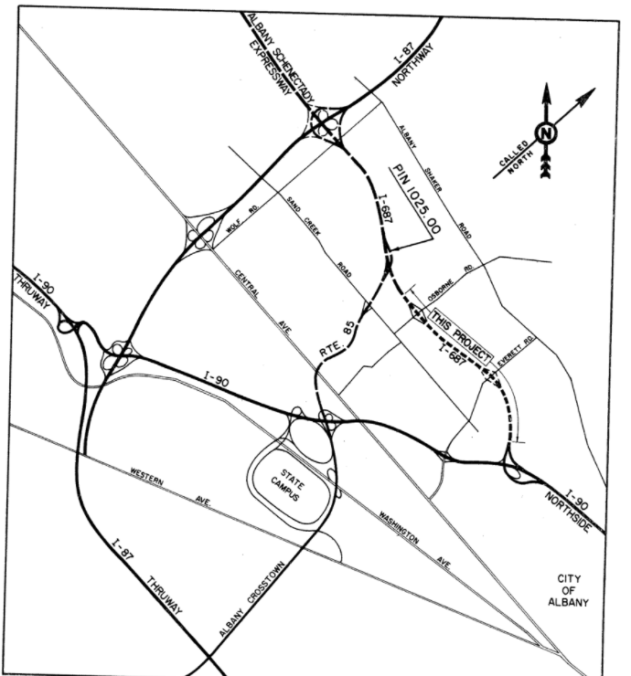 I 687 and NY 85 proposal, from a July 1972 report. From CDTC archives.
NY 85 currently serves as a connector from I 90 to Slingerlands. It carries considerable traffic from mid Albany south.
During the time that the I 687 project was still on the books, there was a proposal to continue NY 85 north to meet I 687 in Colonie. With the death of the I 687 proposal, this extension proposal died as well.
This is a complicated one. The arterial would have run from Loudonville south through Albany to Exit 23. The most likely plan would have gone underground to pass under the east end of Washington Park. Finally, the access highway to the Empire State Plaza would have continued west and gone underground to meet the arterial - at an underground interchange.
Three plans existed for the interchange on the east end of Washington Park - one elevated, one at ground level and one underground. The underground version was strongly preferred.
Reportedly NY DOT acquired the land between Hudson and Jay Streets in anticipation of building the connector from the Empire State Plaza. The buildings sat empty for some years but were sold off when the plan was cancelled.
Apparently this proposal failed due to the high cost of land acquisition. That's probably just as well. Ambitious construction projects had already done quite a lot of damage to Albany.
The existing freeway style section of US 9 between Loudonville and Arbor Hill is officially called the "Lark Dove Connector" and is the only part of this project that was actually constructed.
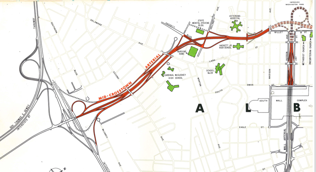 Mid Crosstown from Exit 23 to the Washington Park interchange. From CDTC archives.
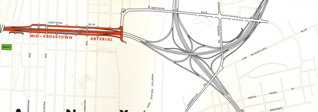 Mid Crosstown north of Washington Park. From CDTC archives.
The South Albany Expressway would have continued from the current southern end of the Northway, parallel to the Thruway between Exits 24 and 23, meeting up with the south end of I 787. Exits 23 and 24 would have been similar if not identical to what they are today, but the southern ends of the Northway and I 787 would have been quite different. The expressway would have had an interchange with NY 85 at about its midpoint.
This highway proposal appears in the 1967 planning document but not in the 1973-74 document.
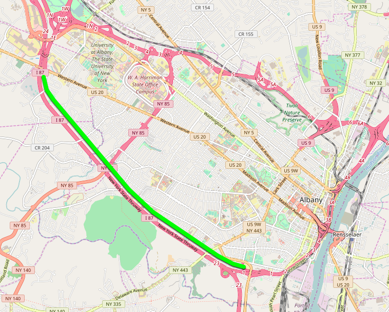
Approximate location of the proposed South Albany Expressway. Modern background map © OpenStreetMap contributors.
The proposal was to build a freeway from the end of the Dunn Bridge up the hill to meet I 90 at the current interchange with NY 43. Presumably this highway would have been signed NY 43. When I 90 was built, provision was made for the ramps and bridge needed for the NY 43 extension, and they sat unused for many years. Eventually they were used when the west end of NY 43 was reconfigured and extended to I 90.
If this proposal had been built, morning and evening commuting patterns might be a bit different today.
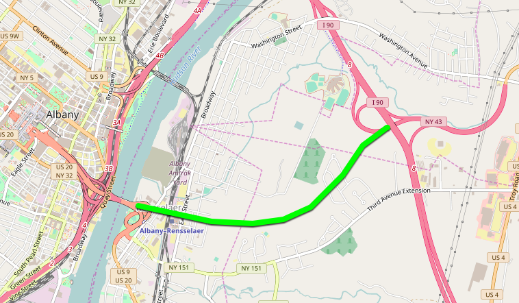 Approximate route of NY 43 extension proposal. Modern background map
© OpenStreetMap contributors.
Approximate route of NY 43 extension proposal. Modern background map
© OpenStreetMap contributors.
The 1973-4 map shows I 88 meeting I 90 at the modern Exit 25 and extending north and east nearly to the Mohawk, and then turning east to meet the west end of the freeway section of NY 7. I 88 would have overlaped NY 7 to the end of the Collar City Bridge. There may also have been a plan to extend I 88 to Bennington although the details are unclear.
A highway with limited access would be constructed from the Troy end of the Menands Bridge (NY 378) north through Troy to Hoosick Street. A proposed extension to this corridor would run from Hoosick Street on to NY 40.
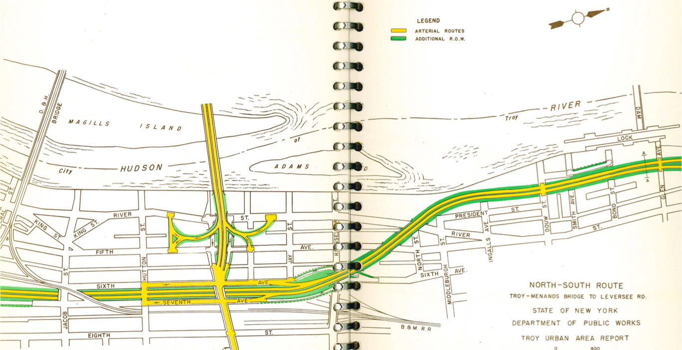 North South Corridor plan for Troy, showing the old Green Island Bridge and an early concept for the Collar City Bridge (Hoosick Street Bridge). From CDTC archives.